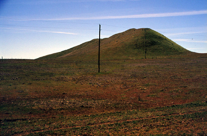
On the divide between the old Palouse River channel and the Snake River, there are streamilined hills like the one shown in this picture that indicate that the floodwaters of the Missoula floods reached up this high. Aerial views of the area show the streamlined nature of the hills better than this shot, but you get the idea. Before the floods, the loess deposit would have been much thicker and the bits that remain here are simply the extra loess that the flood couldn't carry away.