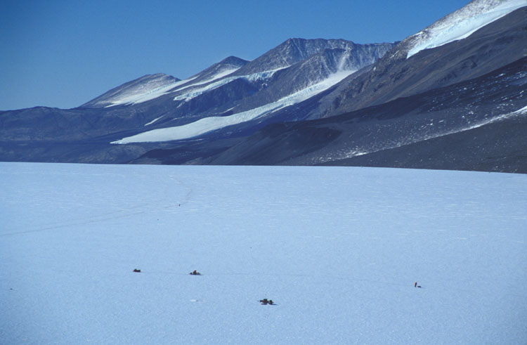
This is Twit and Dave's radar set up (three blobs connected by ropes). On the left is the snowmobile. Not too far behind the snowmobile is a sled that holds a person, a generator to power the radar, an oscilliscope to view the radar signal, and a computer to record the data. The antenna is strung out between the first sled and the second sled which is way behind the first. Measuring the time it takes for a radar signal to go from the transmitter down to a natural reflector in the ice (the ice/bedrock contact is often the strongest reflector) and then back to the receiving antenna enables an estimate of the distance from the surface to the reflector. This data is useful to us because it tells us how deep the ice is. Over the course of the season, Twit and Dave did a number of transects across the glacier at locations that corresponded to the GPS survey lines. The GPS measurements of surface velocity and the radar measurments of ice depth, along with some assumptions about the nature of the ice flow allow a calculation of the volume of ice that moves past any point on the glacier.